Full Size Burial Lot Rates
- Non-ratepayers – $904.00 (HST incl.) – includes perpetual care & maintenance
(Care & Maintenance = $320 + Lot Fee = $480 + HST = $104)
- Ratepayers – $553.70 (HST incl.) – includes perpetual care & maintenance
(Care & Maintenance = $290 + Lot Fee = $200 + HST = $63.70)
Open and Closing Rate
- Open and close (Cremains Site) – Weekdays prior to 4:30 p.m. – $203.40 (HST incl.) ($180.00 + $23.40 HST)
- Open and close (Cremains Site) – Weekdays after 4:30 p.m. and Weekends – $271.20 (HST incl.) (203.40 + [Additional Fee $60 + $7.80 HST])
For further information on Plummer Additional Cemetery Fees and Guidelines, please click on the links below:
Five Cemeteries in the Township of Plummer Additional
ACTIVE CEMETERIES
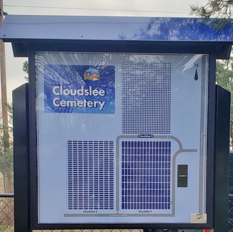
A photo of the map of burial lots located at Cloudslee Cemetery.
Cloudslee Cemetery
Burial lots available for sale
Licence #CM-00034
History – The Cloudslee Cemetery property was initially owned by Norman McEwan. In 1896 the cemetery location was officially surveyed. The oldest known grave is dated 1879. This grave was relocated from an adjacent location following the property survey.
There are 3 sections in this cemetery. Section 1 is the original property donated by Mr. McEwan. By 1949, all of the plots in Section 1 had been sold; subsequently a Section 2 was established on land offered by Mr. Arthur Chapman Sr. In 1978, section 2 of the cemetery expanded again on land purchased from Joesph Charron to meet the community’s needs for more burial plots.
Directions – From Bruce Mines on Highway 17, turn onto highway 638, head north about 3.5 km, turn right onto Cloudslee Road and head about 3 km. The cemetery is located on the left side.
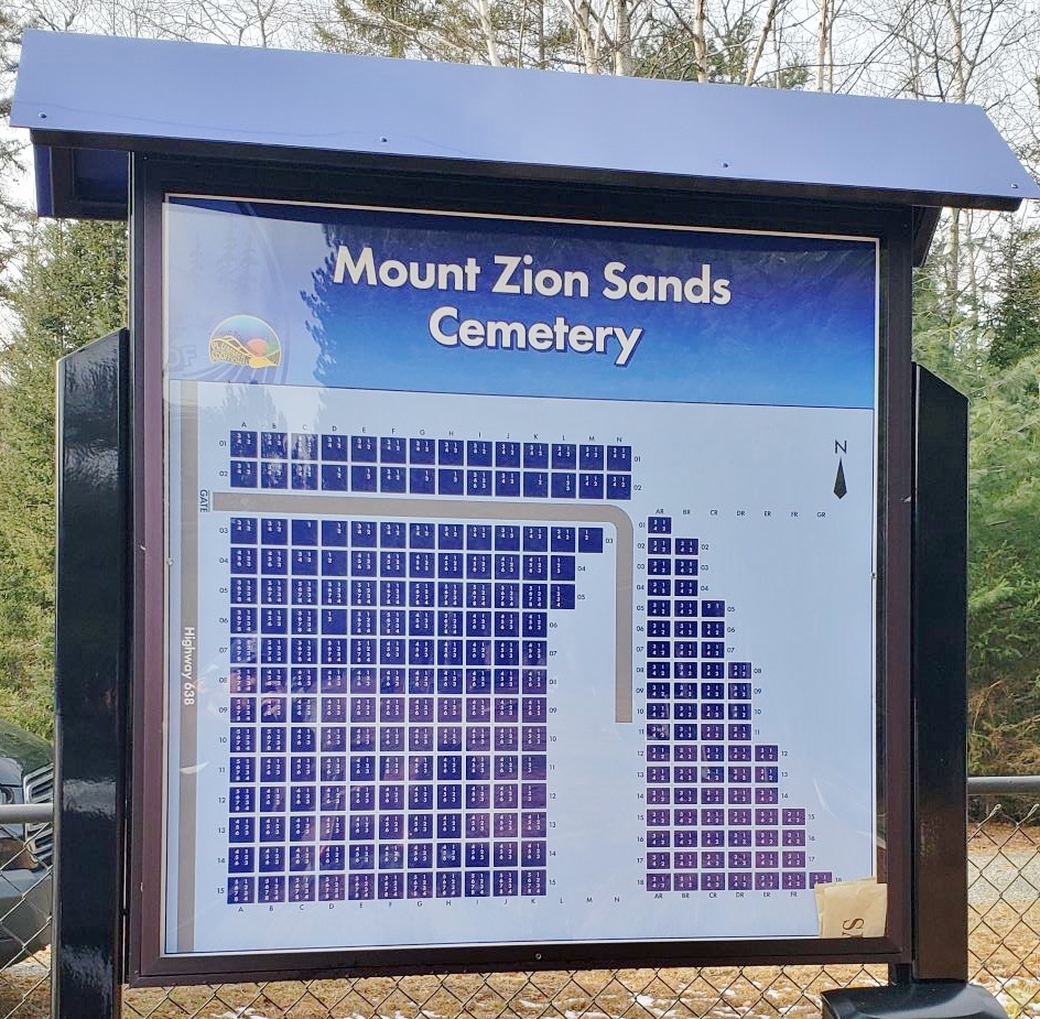
A photo of the map of burial lots located at Sands Cemetery.
Sands/Mount Zion Cemetery
Burial lots available for sale
Licence # CM-05043
History – Sands Cemetery is located in the Township of Plummer Additional, on a level sandy area which originally a part of the local picnic grounds, fondly nicknamed “The Sands”. It is surrounded by a stand of planted white and red pine approximately 65 years old.
Directions – From Bruce Mines on Highway 17, between Sudbury and Sault Ste. Marie, go north on Highway 638, about 16km (7.2 km north of Rydal bank). The Cemetery is on the east side of the road just before it crosses McKinnon Creek. Alternatively, you may access this cemetery via Highway 638 east from Echo bay to Ophir, from there head south towards Bruce Mines.
INACTIVE CEMETERIES
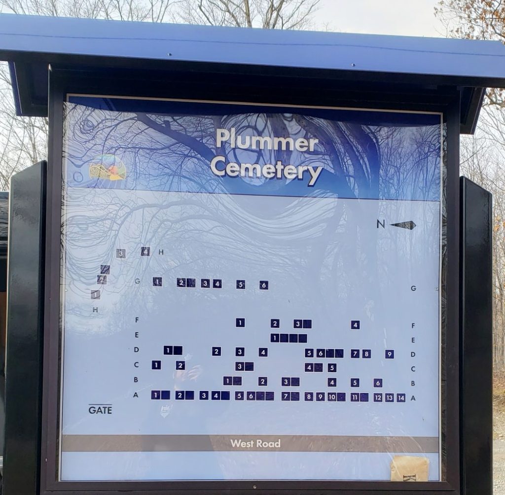
A photo of the map of burials located at Plummer Cemetery.
Plummer Cemetery
No lots available Licence # CM-05042
History – The Plummer Cemetery is located on Lot 6, Con 4 in the Township of Plummer Additional, about 4km west of Rydal Bank. It was originally called Finlayson’s Cemetery, because it was north-west corner of Alex Finlayson’s farm, and it was mainly relatives of the Finlayson’s that were buried there. Many people were buried there without any headstones and because of this the cemetery was closed.
Directions -From Bruce Mines on highway 17, turn onto highway 638 at Bruce Mines, go to Rydal Bank a distance of about 9.5 km, turn left onto Plummer Rd. travel west for about 2 miles, turn right onto West Rd., go to the top of the hill, the cemetery is located to the right
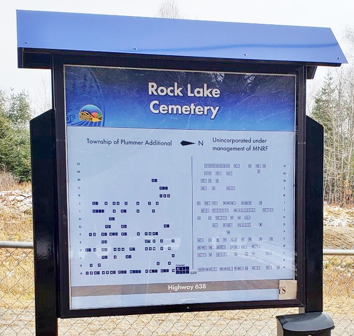
A photo of the map of burial locations in Rock Lake Cemetery.
Rock Lake Cemetery
No lots available Licence # CM-00035
Directions -From Bruce Mines on Highway 17, between Sudbury and Sault Ste. Marie, go north on Highway 638 about 9.5 km to Rydal Bank. Continue North on 638 for 9 km. The Rock Lake Cemetery is next (at 9 km) on the west side of the road on a knoll.
Alternatively, you can reach this cemetery by taking Highway 638 from Echo Bay to Highway 561 at Ophir, from there head south for about 2.75 km.
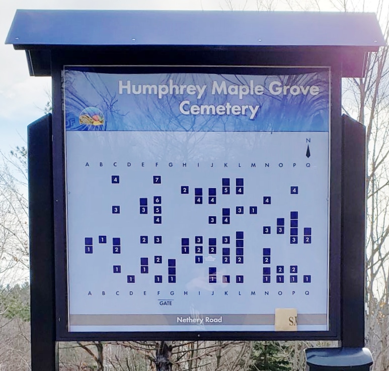
A photo of a map of burial locations at Humphrey Cemetery.
Humphrey/Maple Grove Cemetery
No lots available Licence # CM-05059
Directions – From Bruce Mines on Highway 17, between Sudbury and Sault Ste. Marie, go north on Highway 638, about 11 km (2.8 km north of Rydal Bank). The cemetery is on the Nethery Rd. to the west, just off the highway. (The Ledyit Rd to the east is just past this road; you have gone too far)
There is a high rock bluff to the north of the cemetery and a gravel pit on the south side of Nethery Road.
The Bereavement Authority of Ontario – A Guide to Death Care in Ontario
Please click on the link below in order to obtain information regarding the BAO Consumer Information Guide: